Emperor Augustus gives his name to the Via Augusta, a route that connected Rome with Cádiz and had a total length of 2,975 km. The construction of these roads followed three fundamental principles: durability, utility, and accessibility.
The Via Augusta Trail is a route that can be done on foot or by bike. The path has been defined by preserving some sections of the original route and, for the most part, runs close to the old road, now occupied by lanes for vehicular traffic only. This proximity to the historic route is precisely why it is called the Via Augusta Trail.
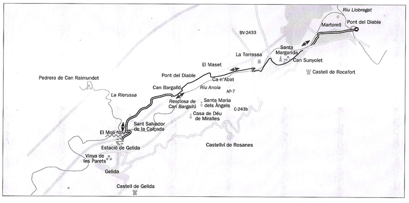
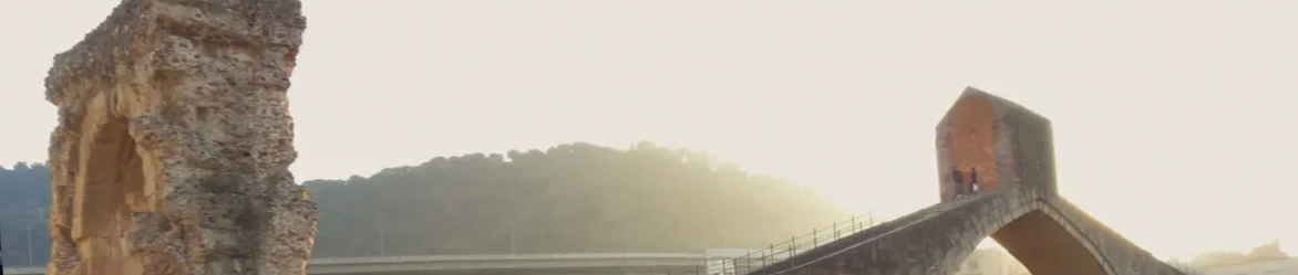
The route we propose starts at the Devil’s Bridge of Martorell and ends at the Arch of Berà in the municipality of Roda de Berà, as described in the book On Foot along the Via Augusta by C. Pla, J. A. Ventura, and M. Vives.
Recommended stages of the Via Augusta Trail:
-
Martorell / Sant Sadurní (17 km, 4 h on foot)
High-accessibility and short-stage section. Highlights include archaeological heritage, such as the Pont del Diable or de Sant Bartomeu and the Hermitage of Santa Margarida. Also recommended by bike. -
Sant Sadurní / Els Monjos (23 km, 5 h on foot)
Stage with good accessibility but longer. Also recommended by bike. -
Els Monjos / Vendrell (18 km, 4 h 30 min on foot)
Characteristic wine-growing landscape. Also suitable for bicycles. -
Vendrell / Creixell (13 km, 3 h on foot)
Notable for the Roman remains in Creixell, such as the Berà Arch. -
Roda de Berà / Tarragona (25 km, 5 h 30 min on foot)
End of the section with the architectural complex of Tarraco, declared a World Heritage Site.
The Path of the Via Augusta combines history, archaeological heritage, and natural and cultural landscapes, offering a unique experience for both walkers and cyclists.