Martorell lies across two major geological and morphostructural units: the southern reliefs of the municipality, which are part of the northwestern slope of the Coastal Range, and the entire northern sector, flatter, located in the Vallès-Penedès tectonic trough or depression.
The geomorphology of the municipality has been shaped by the fluvial dynamics generated by erosion and the sediments contributed by the Llobregat and Anoia rivers, and their tributaries.
The Natural Heritage of Martorell is rich and diverse, largely shared with neighboring municipalities. These areas face strong urban and usage pressures, as well as the passage of numerous infrastructures. Population growth increases the value of these environments, turning them into a natural treasure that must be protected for future generations to enjoy.
Although the municipality does not have any area included in the Plan of Areas of Natural Interest (PEIN) of the Department of Environment and Housing of the Generalitat of Catalonia, it does have two protected areas. Firstly, the entire stretch of the Llobregat River up to the Congost forms part of the Montserrat-Roques Blanques-Riu Llobregat zone of the Natura 2000 Network, which includes habitats of community interest, areas of interest for species of community value, and bird protection zones. Conserving river courses is essential to maintain the connectivity of natural spaces.
Secondly, the Parc Forestal de Can Cases enjoys a protection status higher than the local level, recognized by the Generalitat as a public utility forest of social and recreational interest, thus reinforcing the importance of the Natural Heritage of Martorell within the territory.
CAN CASES FOREST PARK

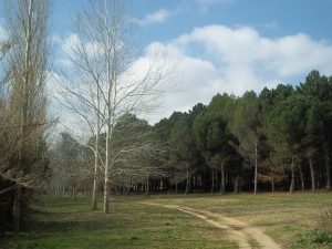
The Can Cases Forest Park is an essential area for the municipality of Martorell, both for its status as a public utility forest and for its recreational function, serving as a setting for environmental education activities.
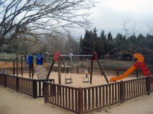
This facility offers barbecues, picnic tables, playgrounds, parking, and a sports area with basketball and football courts. Can Cases is a good area for outdoor sports activities such as walking, jogging, mountain biking, horse riding, among others.
It is also a good place for observing vegetation. The typical Mediterranean holm oak forest is the most representative community, along with the riparian forest along the watercourses. The park also has conifers and other riparian trees. Regarding fauna, more than 70 bird species and 30 butterfly species have been observed, as well as some amphibians and reptiles typical of Mediterranean areas, such as the pond turtle, and mammals such as badgers, foxes, genets, shrews, and wild boars.
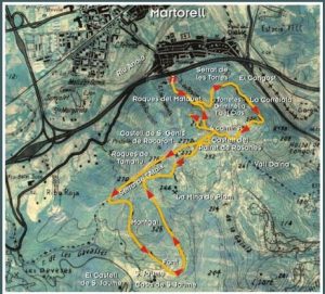
Since May 2014, the park has had an orienteering course of about 2.5 km that runs along well-marked paths and trails.
LES TORRETES ROUTE

The mountainous area of Martorell is concentrated in the southern part of the municipality, where the ridge marks the municipal boundary.
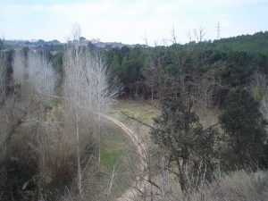
Numerous paths and trails cross this part of the mountain, which borders the protected area of the Ordal Mountains and serves as an excellent viewpoint to observe the entire municipality and much of the northern part of the region.
The Torretes Ridge mainly corresponds to the northern face of the Ataix Ridge. It was formerly occupied by vineyards and today by shrub and pine forests.
In July 2021, an especially dry summer, a fire burned a large part of the northern face.
From the time when vineyards were cultivated, many traces remain, as well as remains of water mines. Due to its role as a connection between the Ordal and Vallès, this area can be considered part of the biological corridor of the Anoia and Llobregat river basins.
The Torretes Ridge is a great viewpoint over Montserrat and Martorell and gets its name from the watch towers that were built to monitor potential invasions. For this reason, in 2021 a viewpoint was established at the Griminella Tower.


